6 pm update below - with frightening photos......
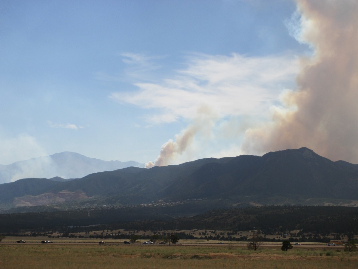 |
| (From Yesterday - Pikes Peak to the Left, Blodgett Peak on the Right) |
I haven't personally checked them all, but from what I have seen and heard the trails closed are:
* Waldo Canyon (where the fire started back on Saturday)
* Red Rocks Canyon
* Barr Trail (on Pikes Peak and scene of the Pikes Peak Marathon)
* The Incline
* Palmer Park
* N. Cheyenne Canyon Park
* Sections of the Santa Fe Trail (at Sth end of the USAFA)
* Stanley Canyon
* Stratton Open Space
* Ute Valley Park
* Garden of the Gods
* Pulpit Rock Park
* Section 16
* Highway 24 is also closed between Manitou Springs and the El Paso / Teller County line, along with Pikes Peak Highway - the road to the Summit - and also the scene of the Pikes Peak Hill Climb on July 8th: may be impacted.
I drove to the Blodgett Peak Trailhead at about 1pm this afternoon and saw the sign of the trail closure. In the few minutes that I was there and on the drive away - the smoke increased noticeably so I drove up a nearby road overlooking Ute Valley Park and Flying W Ranch and took the following photos of the fire flaring up again - along with several of the planes fighting the fire.....


The Summit of Pikes Peak has a live camera pointed towards the fire
 |
| 3:10 pm looking NE towrds the fire from Pikes Peak Summit (14,415') |
++++++++++++++++++++++++++++++++++++++++++
++++++++++++++++++++++++++++++++++++++++++++++++
6pm update - I drove to Manitou Springs from my office (at about 3 pm) in Rockrimmon - took 20 minutes - for an appt - then started heading back past Garden of the Gods, up 30th, to Centennial, then down Allegheny to Rockrimmon.
On my way back the fire crossed the front range and into NW Colorado Springs. Took me 2 hours to get back to my office where I am posting these and leaving asap..... These first 4 photos from Old Colorado City area.


These next photos from Garden of the Gods heading North - the fire just crested the ridge.


Now I am on 30th St, still heading North as the fire is now coming down the front slopes towards Peregrine / Nth Mountain Shadows


As I got to Centennial / Allegheny I could no longer see the front range, in fact I could barely see anything at all. 2 photos of the sun, one of the traffic and ash. Very strong winds right now, I heard as I was stuck in traffic of homes on fire and firefighters being forced to retreat. This is not good.


from a former Blodgett resident - thanks for the pics
ReplyDelete